

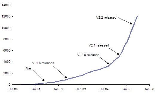
Since the release of LandSerf 1.7 in December 1999, downloads of LandSerf have been monitored and
have increased steadily to the current rate of about 1000 per month. The simple form you have to
fill out before receiving a copy of the software allows us to see where in the world people are
using the software, and what applications they intend using it for.
New releases of the software seem to increase numbers of downloads, most likely from existing users
downloading a newer version. We also see a slowdown in downloads every Christmas when people have
better things to do with their time than a bit of surface analysis.
By supplying your email address and analysing the IP address of all downloads, it is possible to
estimate the country of origin of most users of LandSerf. About 70% of downloaders provide valid
addresses from which origin can be estimated.
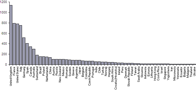
Country of origin can be mapped by relating country of origin to global coordinates using a geographic
name server. The maps below were produced using LandSerf by setting a large point symbol size with
text labels reflecting the number of downloads for each country. The colour scheme uses transparency
which decreases, and saturation which increases, with larger download numbers. The country outlines were
produced by rasterizing data imported from the Global
Hierarchical Shoreline database in LandSerf.
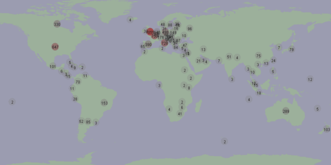 Global distribution of LandSerf downloads
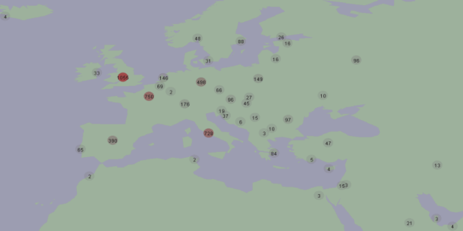 European region distribution of LandSerf downloads